Planning Application Visuals
ABOUT THE VIDEO
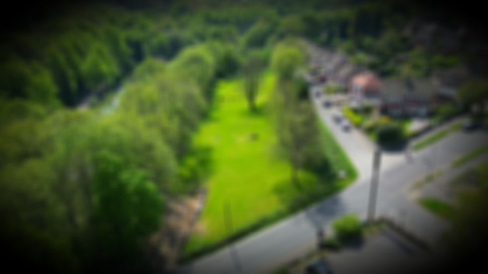
This video provides a photo-realistic aerial visualisation of the proposed field layout as submitted within our planning application to Sheffield City Council.
On desktop devices, you can also explore a fully interactive 3D model via the link above, allowing you to view the site from any angle and better understand the layout and positioning of each feature. Please note that this interactive experience is not currently available on mobile devices. We welcome any feedback, questions, or suggestions, which can be submitted via the comments section on this page.
HOW IT WAS MADE
This CGI reconstruction was created by combining high-resolution drone photogrammetry with GPS-derived topographical survey data. The photogrammetry process generated a dense point cloud and textured mesh of the existing site, which was then enhanced using Gaussian splatting techniques to produce a more efficient, photo-realistic real-time render of the environment.
Proposed elements—including the car park, field shelter, fencing, and planned vegetation—were modelled in Blender and precisely aligned within the surveyed coordinate space. This hybrid workflow allows the virtual scene to closely match real-world scale, positioning, and perspective, providing an accurate and transparent representation of how the development will sit within the existing landscape.
Looks absolutely fantastic! The video really gives an insight of whats to come and i cant wait to visit!! Lets hope planning goes through so all of us can use this fabulous facility!!
We are planning on getting another dog and will book to do training with him. It will be a fantastic resource.
Need more of these , safe and secure fields for our dogs to run around !
This looks amazing and can’t wait to pay a visit, great to have a local secure field for my pooch to run
Looks wonderful and only adds to the area and also the views of the houses opposite. Promote small businesses please
Amazeing local resident my spaniel with love this park
Looks great and secure
This looks brilliant! Can't wait
This is absolutely fantastic.